

You are here
Mapping populations at risk: John Snow meets the 21st Century
Share
Game of Thrones fans will be disappointed to learn that this isn’t a fandom article about Jon Snow – that’s Jon without an ‘h’, by the way. It is in fact reference to John Snow – with an ‘h’ – often thought of as one of the founders of modern epidemiology.
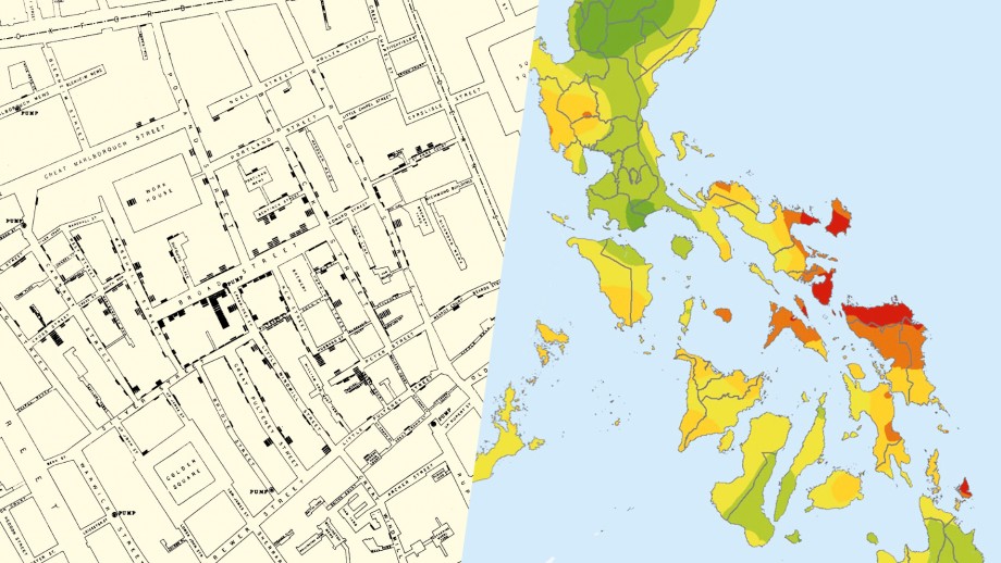
John Snow famously mapped a cholera outbreak in London in 1854, tracing the source of infection to a contaminated public water pump on Broad Street. Not from “bad air” as was the common belief at the time.
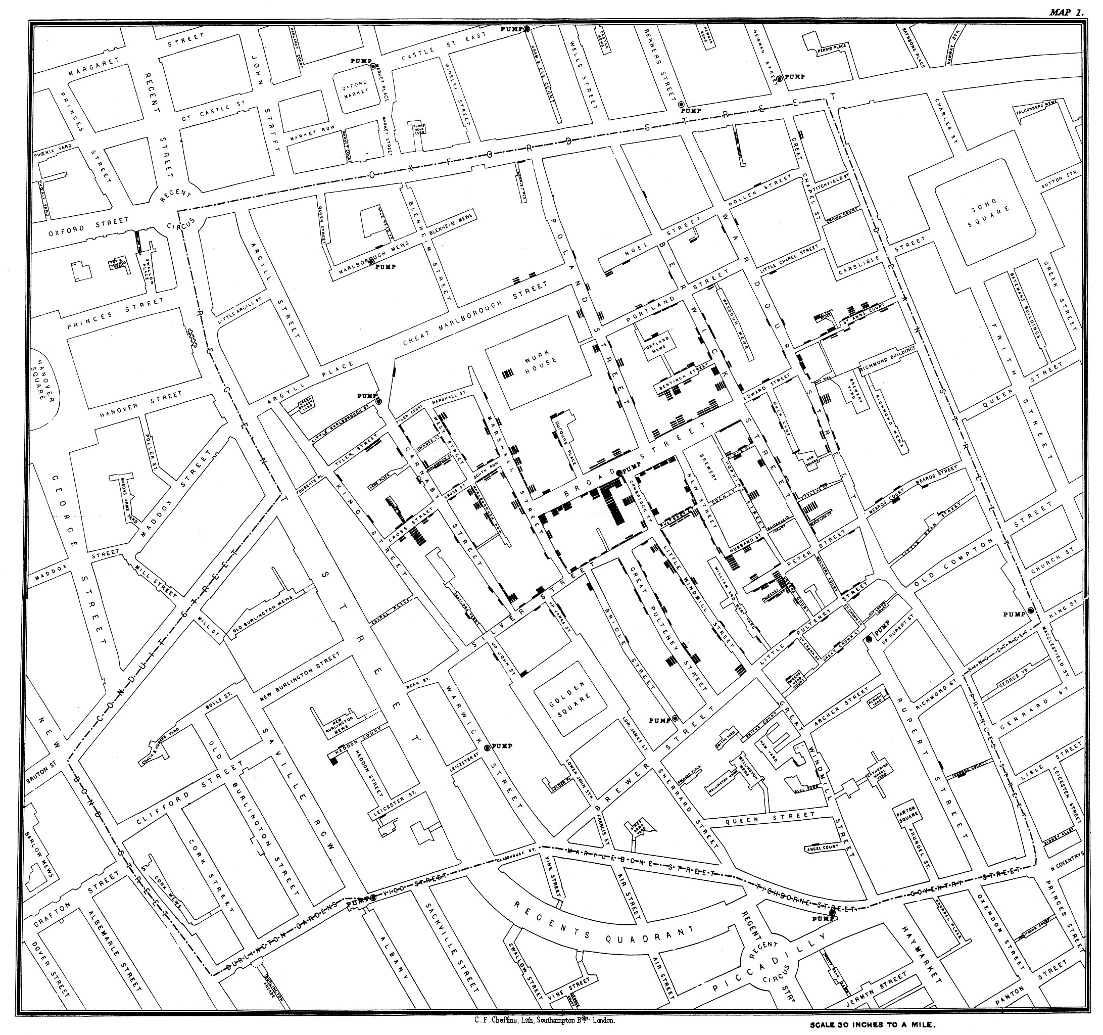
Original map made by John Snow, highlighting clusters of cholera cases in the London epidemic of 1854.
Maps continue to play an important role in epidemiology today. Sure, some are still simple hand drawn maps hastily made in the field. But modern epidemiologist also have access to advanced computer modelling called Geographical Information Systems.
These systems can combine complex data to produce maps that clearly and simply visualise this array of information. In short maps are fantastic tools, to which Dr Tsheten Tsheten, a spatial epidemiologist, agrees:
“These maps are intuitive, and easy to understand. They can show us patterns across space, help us understand trends over time, and aid in decision making.”
Such maps might include outbreak mapping or cluster mapping – think of all the COVID-19 maps we have seen over the last few years. Or show a correlation between a health outcomes and environmental or socioeconomic factors.
Tsheten and a team of researchers demonstrated the usefulness of maps in a recent study on the distribution and determinants of soil transmitted helminths (STH), intestinal worms that are transmitted through soil. While Tsheten’s study focussed on the Philippines, STH are of global concern—infecting an estimated one-in-four people worldwide, often resulting in nutritional and physical impairment in children.
The spatial variation of STH infections in the Philippines was last described using a 2005–2007 national survey, so there's a strong need for creating a new map using up-to-date data. In their study, Tsheten and collaborators presented the most recent findings of a national survey conducted between 2013 and 2015, where stool samples were taken from more than 28,000 public school students, from kindergarten to Grade 10. These were then examined under a microscope for the presence or absence of worms.
As you can imagine, collecting poo from this many children is no small undertaking. When you combine other logistical and resourcing constraints, and the task becomes even more daunting. The good news, according to Tsheten, is that he ability of STH to survive outside a human host (i.e. in the soil) is greatly influenced by local climate, elevation, vegetation, and soil type—which lends it perfectly to epidemiological mapping.
“Temperature, for example, can affect the longevity and desiccation tolerance of the parasites. Soil pH and the presence or absence of vegetation can affect the biology and ecology of the parasites,”
“These variations in climatic and environmental conditions helps predicts the prevalence of STH across the country.”
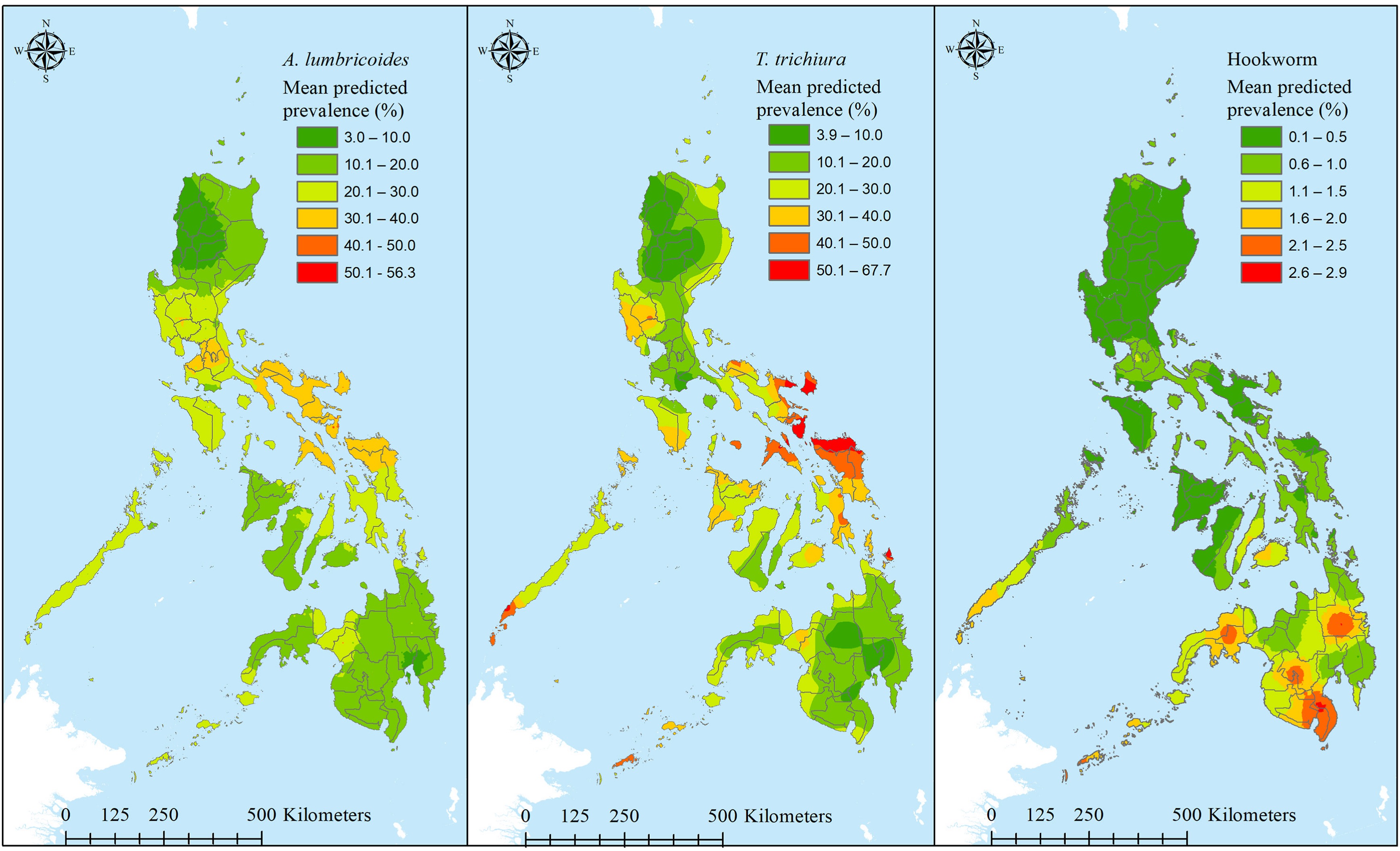
Predicted mean prevalence of parasitic worms Ascaris lumbricoides, Trichuris trichiura and hookworm in the Philippines. Image source: DOI: 10.1016/j.lanwpc.2023.100974
Tsheten and his team found that STH prevalence was positively associated specific environmental factors. These factors could then be used to model STH in areas where physical sampling had not been conducted, as well as predict hotspots to focus prevention and control activities.
“Areas with higher transmission of STH have reduced in the Philippines compared to previous risk-mapping studies, possibly related to effectiveness of the deworming programs,”says Dr Tsheten,“Targeting interventions on the remaining foci of transmission will be of paramount importance in the elimination goal of STH in the country.”
In their battles against invisible enemies, Snow—both John and Jon—knew something, and so do we. Armed with the insights from mapping epidemiological data, we are better prepared combat a range of diseases and health complications… and maybe even winter?
Find out more about Tsheten and his team’s mapping of STH in the Philippines in their The Lancet Regional Health: Western Pacific article: Risk mapping and socio-ecological drivers of soil-transmitted helminth infections in the Philippines: a spatial modelling study